-
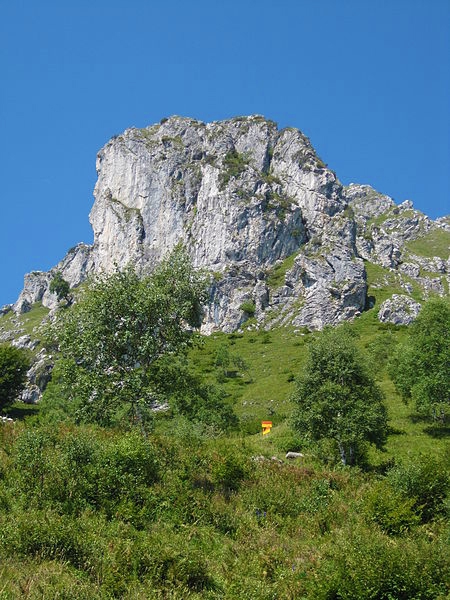
Hiking Monte Grona -
Hiking Monte Grona -

Hiking Monte Grona -
Hiking Monte Grona -
Hiking Monte Grona
Hiking Monte Grona Plesio Like
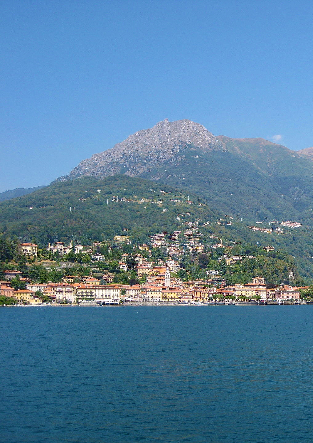
Starting from Breglia
From the bus stop at Breglia (749 m) cross the road and ascend the small road leading up to Monti di Breglia (sign indicating Rifugio Menaggio). At the second bend, just beyond the fountain, you find the first shortcut to the right (sign Monti di Breglia/Rifugio Menaggio). The steep trial ends up on the road again, which you cross to pick up the next shortcut. After 20m, at the high tension must turn right. The steep trail leads on the road once more, wich you follow for about 300m. Then you find the next shortcut to the left which leads across a field. Cross the road another time and follow the trail through the woods wich leads on the road at Monti di Breglia (996 m.)
After another 100 m you reach a picnic area with fountain and beautiful views; here you leave the road and follow the trail over some rocks up to the left (sign). Once on this trial you continue to follow the signs> You reach a open space used as parking area which you cross and then pick up the trial to the left. At the junction where you find the metal trail sign we reccomended the “Sentiero Alto" to the right because of the better view (after heavy snow fall we reccomended the “Sentiero Basso" to the left. It leads among birch trees and broom up to the junction for S.Amate and Monte Bregagno; at this junction you keep to the left. The now even trail leads along the slope and you soon reach the rifugio Menaggio.
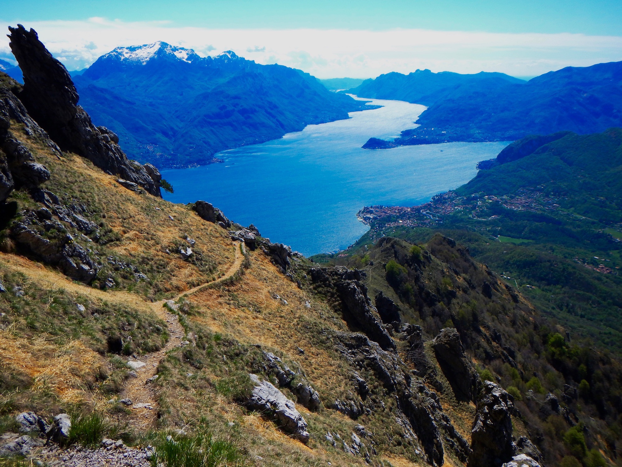
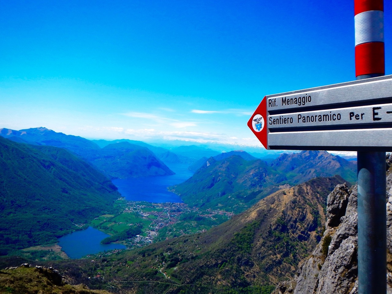
From Rifugio Menaggio
From Rifugio Menaggio there are three different ways to get to the top of the Grona:
Via Normale
time: 1.30 hrs., ascent: 336m; the beginning of this trial (the easier) is behind the rifugio. It leads up to the “Forcoletta" and from there to the left a steep rocky trail leads to the top.Via Direttissima
time:1.15 hrs.; ascent 336m; the beginning of this trial is behind the rifugio. The steep trail winds up the south face of the mountain. During the winter this trial, as it is exposed to the south, remains snow covered less time compared to the Via Normale on the north side of the mountain.Via Ferrata
(Only for alpinists with adequate equipment) Time: 3 hrs. In order to reach the beginning of the Via Ferrata you follow part of the Via Panoramica.Hiking Information
| Start From: | Breglia |
|---|---|
| Start Elevation: | 749 m. |
| End Elevation: | 1736 m. |
| Elevation Gain: | 987 m. |
| Rest Stop: | Rifugio Menaggio 1383 m. |
| Ascent Time: | 3.30 hrs. |
| Total Time: | 6.30 hrs. |
| Difficulty: | E (via normale) EEA - AR - IV- - D- (via ferrata) |
| Trail Signs: | red-white-red |
More to Explore.
Explore 42 other Hikes and Walks
Stroll through a manicured garden or hike atop a snow covered mountain.